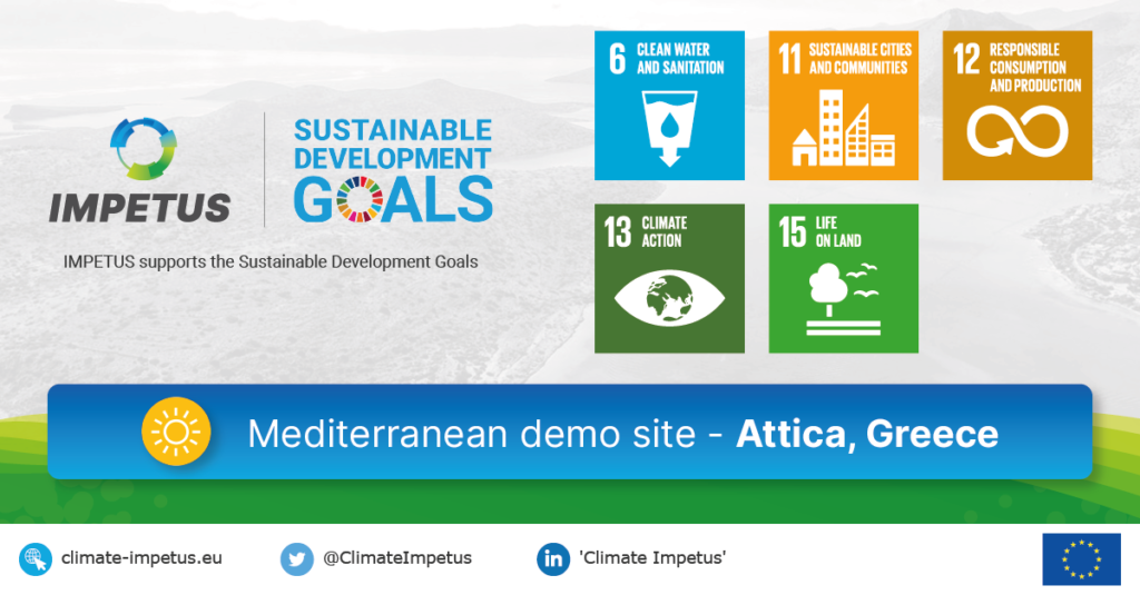
Situation:
The region of Attica in Greece has around 3.7 million inhabitants in a 3,8 thousand km2 area that includes the capital Athens, and the surrounding district.
The area has two main rivers, which have been transformed into covered storm water conduits in urban areas and drain into Saronikos Gulf. Attica is a typical Mediterranean region, subject to strong and increasing impacts caused by climate change and other global change drivers and stressed by various factors arising from dense human population and insufficient sustainable management and protection of the natural environment. A new East Attica Wastewater System (EAWS) offers an opportunity to become a circular economy / climate change resilience hub.
PROGNOSIS
Behavioural change among millions of inhabitants and visitors is needed: a pattern of increasing social and economic conflict demands transformative adaptation solutions
and effective communication.
Contact this team | Επικοινωνήστε με αυτήν την ομάδα :
- Klio Monokrousou – kmonokrousou[@]gmail.com
Issues:
Drought and heatwaves
- High temperatures and reduced rainfall have impacted communities and the environment.
- Dramatic increase in use of energy for cooling.
- Reduced air quality.
Water supply and quality
- Conflicting demands for water for agriculture and the environment.
- Increased tourism and recreational use intensifies competing demands.
- Over-use of groundwater increases soil salinity and decreases crop yields, with economic impacts.
Flash flooding
- Flash flooding from irregular rainfall and marine flooding particularly impact densely populated areas.
Ambitions within IMPETUS:
Scale up use of research and innovation solutions in systemic ways
to trigger development of agriculture, industry and tourism, building on existing initiatives.
Develop regional data-driven platform initiatives to create a digital twin
of the region as a hub for data and knowledge.
Set up a regional user-centred Resilience Knowledge Booster
and link RKB with existing innovation and start-up hubs and co-create a regional adaptation pathway.
Bring together local and regional communities of practice
engaging stakeholders in co-creation and co-ownership of solutions, technological and policy pathways and portfolios.
Implement and test selected innovations in key systems and leverage the EAWS
creating innovation demonstrations throughout the region.
Use immersive storytelling and knowledge networks
to enhance open innovation and data-driven policy making catalysed by the digital twin and RKB.
to pave the way for:
Significant medium-to-longer term investments committed
to supporting the adaptation pathway.
Large-scale citizen engagement
based on diversity and social inclusion as key to adaptation and sustainability.
Adoption of IMPETUS adaptation pathway by authorities
Formal engagement of competent authorities in keeping plans up to date
Creation of new ‘green’ businesses around climate change innovations
Test solutions:
Digital Twin for freshwater and marine management
Technology Readiness Level 5-7
Evaluation of climate change risks is traditionally carried out via the crossing of results from impact modelling under different climate scenarios, vulnerability, and exposure assessment. In most planning conditions the risk assessment is generated from the overlapping of different Geographic Information System (GIS) layers; an effective methodology that is not easy for non-technical people to interpret, however, and is difficult to use in stakeholder co-design processes.
In IMPETUS
- Demonstrate the potential of integrating state-of-the-art GIS representation of multiple variables with advanced 3D visualisation techniques to generate a 4D (3D+time) digital twin of the territory, making visualisation of risk areas and possible impacts much more effective and user friendly;
- Use the digital twin to bring together data, knowledge, stakeholders and innovators to support design and adoption of adaptation pathways;
- Use the digital twin to foster business innovations for climate change.
This work is linked with:
- Greenathon by the Hellenic Ministry of Environment and Energy
- EU Destination Earth Initiative, DestinE,
- Water Framework Directive,
- Digital Single Market Strategy,
- Netherlands Delta Program,
- Troms & Finnmark County Marine Spatial Planning programme 2021-2024
Sewer mining
Technology Readiness Level 6-8
Wastewater mined from sewers is treated at point of demand while the sludge is also used to produce fertiliser for local agricultural uses. Recent improvements to the technology were achieved by EYDAP and the Municipality of Athens.
In IMPETUS
MantisIMS and related online services
Technology Readiness Level 6-8
Mantis Business Innovation has a suite of tools that allow innovation stakeholders to manage operations such as application submissions and evaluations, incubation and progress tracking, community management and so on. The tools have successfully facilitated more than five innovation programs.
In IMPETUS
- Integrate the MantisIMS platform as part of the infrastructure linked to the Attica digital twin;
- Provide access through the digital twin and MantisIMS platform to the region’s ‘innovation ecosystem’ of experts and solutions.
This work is linked with:
- Elevate Greece Programme
- AI4Good Challenge Greenathon
Economic impact assessment of physical climate risk
Technology Readiness Level 4-5:
Socio-Economic tools and risk projections enable the assessment of climate risks and the establishment of projections and metrics regarding future investments.
In IMPETUS
- Identify highly vulnerable hot-spots using open datasets for Copernicus services and satellite-derived variables;
- Transform this knowledge into a specific regional model and include this in the Resilience Knowledge Booster;
- Use the RKB and regional model to elaborate economic assessment metrics to aid decision making about investments and future mitigation plans.
This work is linked with:
- European Investment Bank
- European Central Bank